
Rivers, reservoirs and irrigation sites
Track water levels at suitable locations. Agree the site reference, measurement range and thresholds used by the operating team.
Monitor water levels, rainfall and local weather conditions at priority sites. Envitus Habitat connects field observations with dashboards and configured threshold alerts, giving operating teams records to use within their planning and response procedures.
Define the observations, site coverage and people who will use the data.
Track water levels at suitable locations. Agree the site reference, measurement range and thresholds used by the operating team.
Record local rainfall and compare observations with water level or weather data. Select gauge locations and outputs for water management or preparedness.
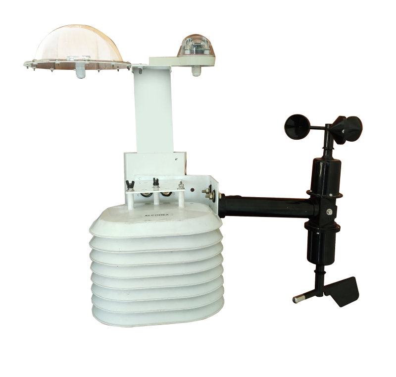
Collect the site weather measurements needed for operational planning, field assessment or training. Match sensors and siting to the intended use.
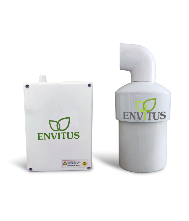
Water level devices collect readings at suitable river, reservoir and flood-prone locations. Define what the reported level represents and how it will be checked at the site.
Review mounting geometry, sensor range, expected water levels and access for inspection. Select the device using the conditions at the proposed location.
Agree a consistent reference for readings and alert limits. Document that reference so operators can interpret measurements and changes over time.
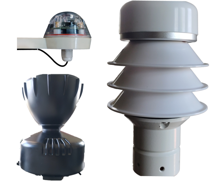
Connected gauges provide rainfall observations from selected locations. Define the gauge method and outputs before using the data in reporting or alert rules.
Specify accumulated rainfall, rainfall rate or both, with units and reporting intervals. Confirm which outputs the selected gauge provides.
Review the installation location, potential obstructions, access and maintenance procedure. Record servicing and verification work with the station history.
Automatic weather stations bring selected environmental measurements into the Envitus monitoring workflow. Confirm the sensor set, mounting and reporting configuration for the data you need.
Agree the relationship between measurements, local functions, remote alerts and operating procedures.
Collect the selected readings at defined intervals. Set measurement references and thresholds appropriate to each location.
Edge analytics, on-device AI and local autonomy are available through project-specific configurations. Define the local task, operating limits and interruption behavior.
Review observations through the Envitus IoT Platform. Configure enabled SMS, mobile or dashboard channels, recipients and communication dependencies.
Assign responsibility for checking readings, assessing the site and coordinating a response. Include acknowledgement, escalation and periodic alert testing in the operating plan.
Water level and rainfall observations support assessment of local conditions. Forecasting models, risk knowledge, warning communication and preparedness need their own defined inputs, validation and responsibilities.
Agree the role of Envitus observations and threshold alerts within that process before commissioning the deployment.
Planning reference: World Meteorological Organization guidance on early warning systems.
These interfaces can be assessed for deployments with defined receiving and response arrangements. Specify compatible equipment, communication channels, receiving operators, acknowledgement and escalation procedures. Test the complete workflow with the responsible team.
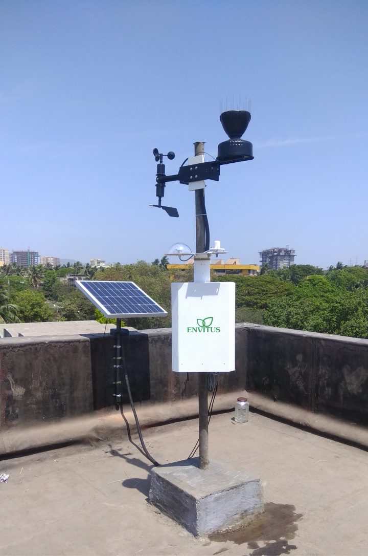
An automatic weather station provided local wind speed, temperature and humidity readings for operational use.
A government-run training institution used an automatic weather station for practical experience in collecting and analyzing local weather data.
Share the proposed sites, measurements and data workflow so the installation and integration scope can be assessed.
Identify locations, required parameters, mounting positions, reference levels and expected operating conditions. Include access for inspection and calibration checks.
Review direct power, solar and battery options against station demand and site conditions. Identify coverage, gateway requirements and recovery behavior.
Define thresholds, recipients, channels and escalation. Assign operators and agree how the complete workflow will be tested and maintained.
Specify any edge analytics, on-device AI, local autonomy or external interfaces. Agree the task, inputs, operating limits and commissioning checks.
Envitus Habitat brings water level, rainfall and weather measurements into a connected monitoring system. The selected sensors and station configuration determine the parameters, reporting intervals and communications.
A sensor reading must be related to an agreed site reference. Confirm the sensor mounting position, measurement range, reference level and verification procedure. Use that same reference when setting thresholds or comparing readings.
Water level monitoring records conditions at the sensor location. Threshold alerts indicate when configured limits are reached. Flood forecasting needs a separately defined model, data inputs and validation, with warning and response arrangements appropriate to the area.
Identify whether you need accumulated rainfall, rainfall rate or both, along with units and reporting intervals. Confirm the gauge method, outputs, siting and servicing requirements for the selected device.
SMS, mobile and dashboard channels can be configured for the deployment. Define thresholds, recipients, communication dependencies and the response procedure for the operating team. Test the enabled channels as part of commissioning.
Solar and battery arrangements can be assessed for compatible equipment. The design depends on sensor power demand, reporting frequency, local conditions and servicing access. Confirm the power arrangement for the selected station.
Local measurements, storage and operating logic depend on the hardware, firmware and project-specific configuration. Agree interruption and recovery behavior for each station. Remote dashboards and notification channels have their own connectivity dependencies.
These additional interfaces can be assessed for deployments with defined response arrangements. Confirm equipment compatibility, communication channels, receiving operators, acknowledgement and escalation procedures for the project.
Share your sites, required measurements, power and network conditions, and the teams who will use the observations.